RUN.
SCAN.
COMPETE.
Find a course near you, run to the controls and tap them with your phone. Your time lands straight on the leaderboard.
- Free
- No sign-up needed
- Real orienteering maps
Discover
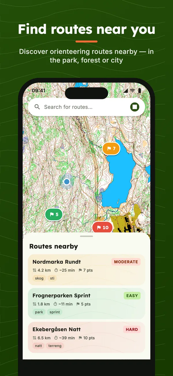
Browse the map to find orienteering routes near you. Filter by difficulty, distance, and popularity. See route details before you go.
Everything you need for your next run
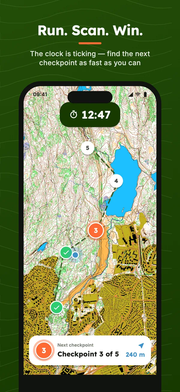
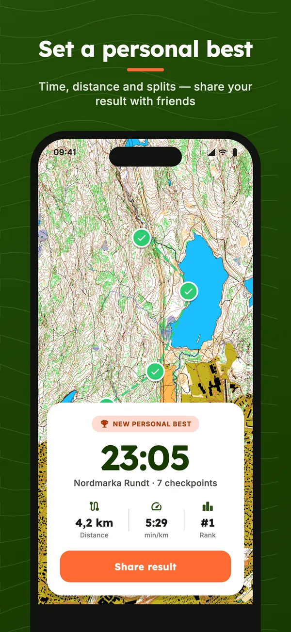
Find a course, follow the timer, tap the controls and see where you placed.
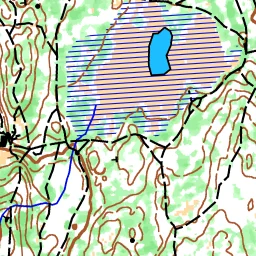
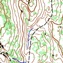
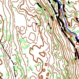
Proper orienteering maps
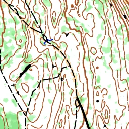
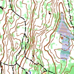
We draw our own orienteering maps from laser scans and open map data: contours, vegetation, cliffs, paths and marshes, the way orienteers know them.
- Contours and terrain from laser data
- Forest runnability, open land and marsh
- New areas added continuously, straight into the app
Outside our areas the app uses OpenStreetMap, so you can run anywhere.
Choose your challenge
Three ways to navigate — from full GPS guidance to pure paper-map orienteering. Pick the level that matches your skill and ambition.
Explorer
Full GPS guidance
See your live position on the map with all checkpoints visible. The map follows you as you run. Perfect for beginners and casual runs.
Navigator
Map without position
The orienteering map and checkpoints are visible, but your GPS position is hidden. Navigate by reading terrain features on the map.
Paper Map
Phone as scanner only
Print the course map and navigate with paper in hand. Your phone becomes a timer and NFC scanner only — the classic orienteering experience.
Explore routes near you
Real routes from the Flagchase community. Click a route to see its checkpoints and details.
Built for real orienteering
NFC Scanning
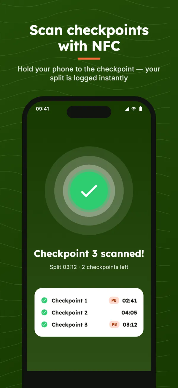
Tap your phone on physical tags. Cryptographic signatures verify every scan.
GPS-Verified Runs
Every run is tracked and validated. Classified by real-time accuracy.
Leaderboards
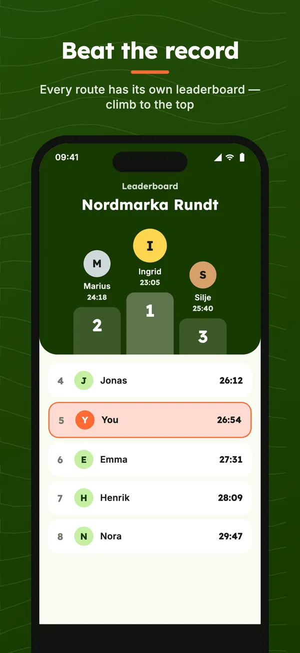
Race to the top. Every route has its own leaderboard.
Route Creation
Walk and drop checkpoints, or place on the map.
Orienteering in PE class
Set up a course around the school in minutes and let the class run it on their own phones. Students need no account, and you see their times on the leaderboard.
Make the course yourself
Walk the loop and drop checkpoints along the way, or place them on the map from your desk.
No accounts for students
Students open the app and run. No email, password or sign-in.
GPS or NFC
Use GPS checkpoints with no equipment, or put up NFC tags if you want to be sure everyone got there.
Paper map when you want
Print the course and let the phone only keep time, just like classic orienteering.
Good questions
Does it cost anything?
No. Flagchase is free to download and use.
Do I need an account?
No. You can start running straight away, and sign in with Apple, Google or Strava later to keep your results.
Does my phone need NFC?
Not always. GPS checkpoints are registered automatically when you reach them. Checkpoints with an NFC tag are scanned by holding the phone to the tag, which most iPhones and Android phones from recent years support.
Where can I find courses?
Open the map in the app to see courses around you. If there are none near you yet, you can make your own.
Can I create my own courses?
Yes. Walk the course and drop controls along the way, or place them on the map. Then share the course with friends or your club.
Do I have to read a map?
No. Pick Explorer for full GPS guidance, Navigator for a map without your position, or Paper map for classic orienteering.
Ready to run?
Flagchase will soon be on the App Store and Google Play. Stay tuned!